

First, as usual, the accessories: a version without the ships and ship tokens. There are two versions of the tokens: one that will look good on this map but will look terrible on almost any other map, and an alternate version that will look terrible on this map, but good on most others.
This is the first of six levels of the Deep Spire. The next few will be much bigger, since the harbor doesn’t go all the way around the column and the other floors do. I’m not sure how long this will take overall, but I’ve got a lot of it planned out already and this has taken much less time than I expected it to, so I think it could be done in about a month.
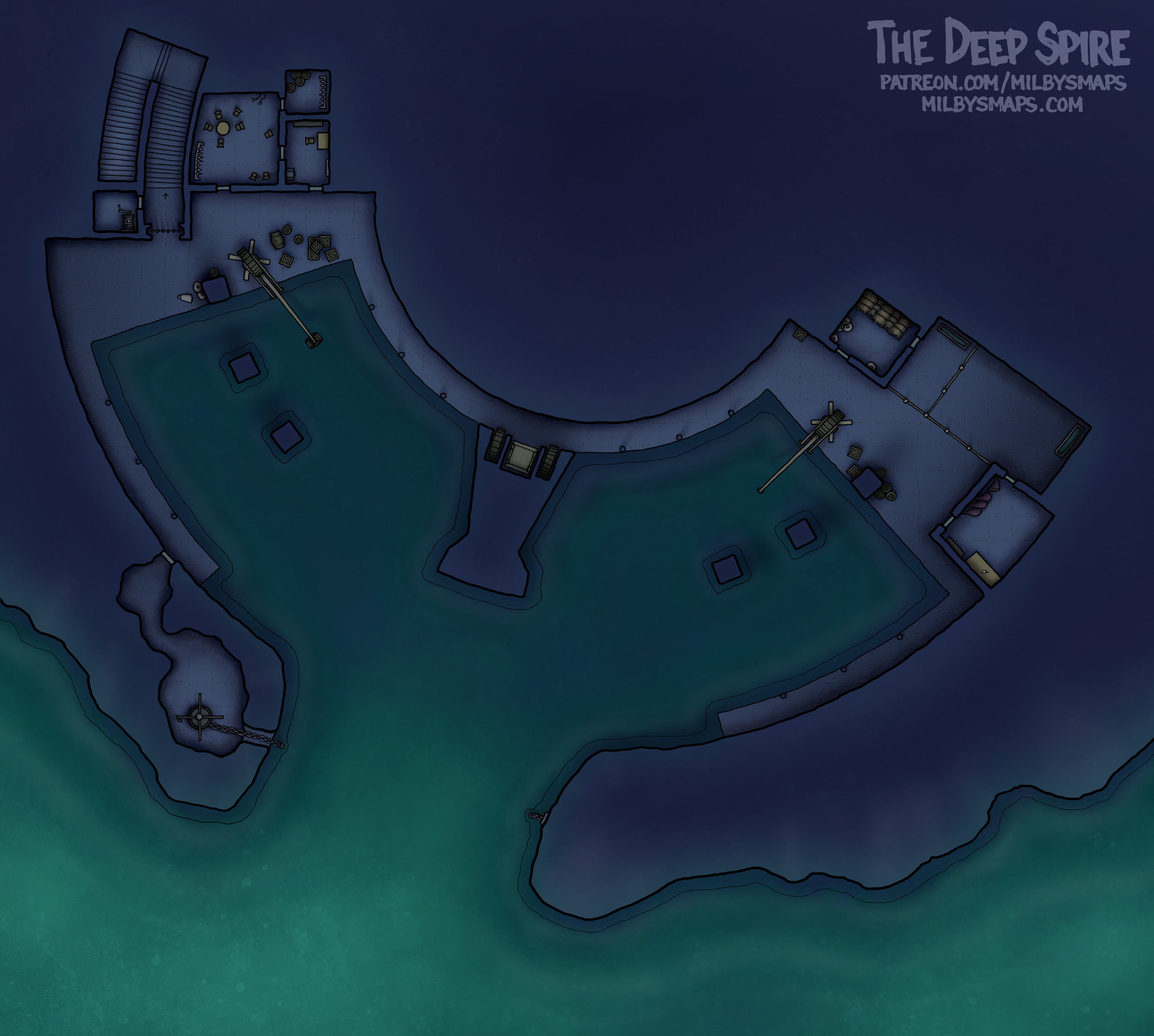
I’ll have DM notes when everything’s finished, but, for now, let’s talk about what we’re looking at. The harbor is a big, open chamber underneath the spire. The ceiling isn’t that high– call it 25 feet (8m)– but this is in the Underdark, so no wind means no sails, which means no masts.
At the entrance to the harbor is a chain boom, like the one in Brazenthrone’s Underdark trading outpost. In the upper left is the gate leading into the spire. On the right are livestock pens. The residents don’t want pigs in the spire, but they do want bacon, so this is where they keep and butcher the animals. In the center, just inside the big support column, is a cargo elevator leading to the second floor. It’s raised and lowered by turning the two big wheels on the sides and is useful for hauling up crates of trade goods or players who failed their persuasion rolls at the gate.
You may have noticed that I changed the colors from what they were in the last post. I decided that using awful, crappy colors might not be the way to go and I decided to use good colors instead. I think that was the right call.
Also, I’m going to make unfurnished versions of all the levels of the Deep Spire. Since I draw everything by hand on paper, that isn’t as simple as turning the chairs off, but it won’t take that long either. I should have the unfurnished version of the harbor up within a day.
Anyway, if you’ve got any thoughts on the map so far, let me know!


