
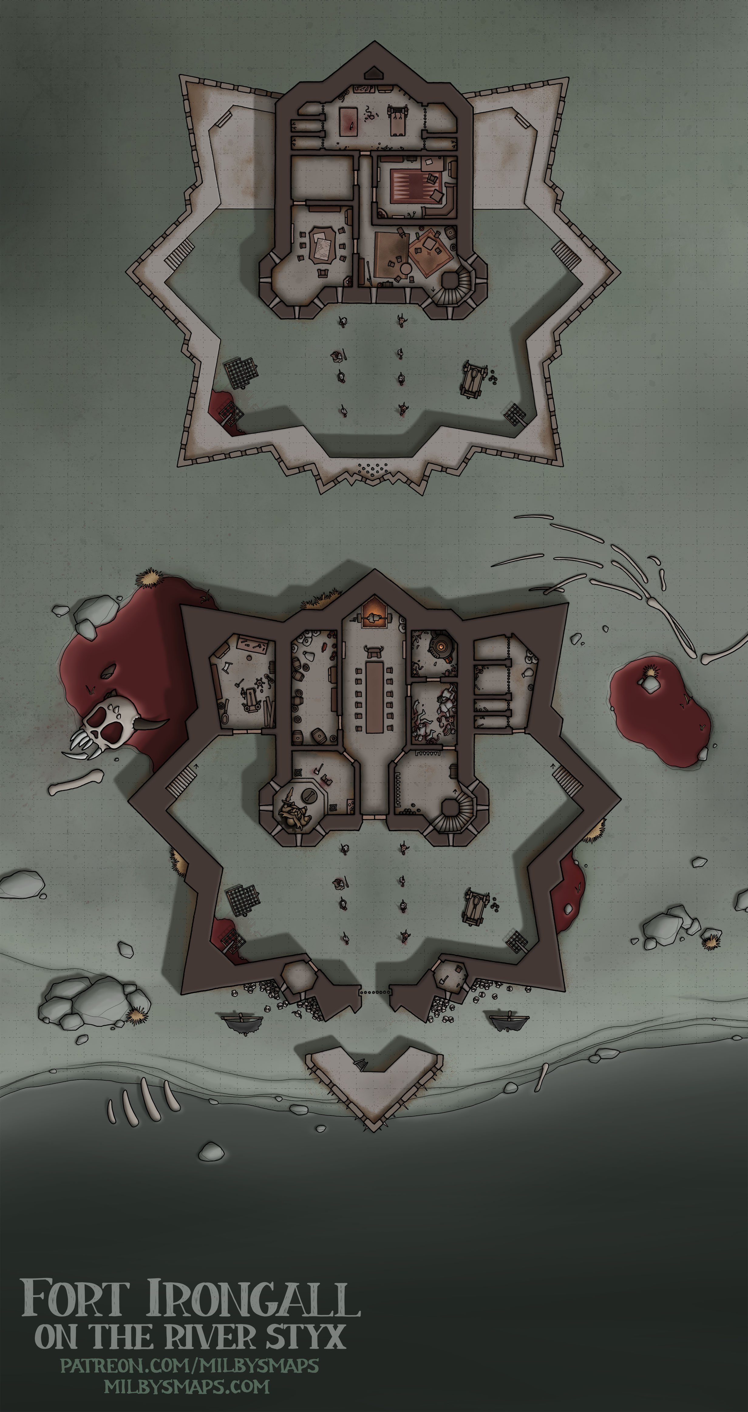
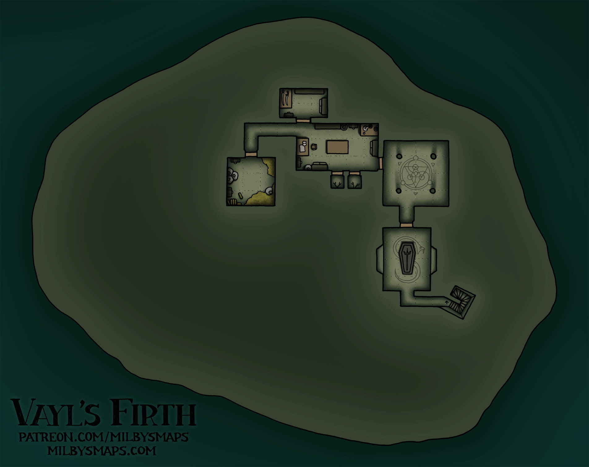
Hell. Hell never changes. Wait, that’s war. Does hell change? I’m not sure. In the traditional D&D cosmology, there are nine hells and they’re all different, so I think we can conclude that hell does, in fact, change. In a sense, anyway.
With that settled, I’m curious what you think about my depiction of hell. We’ve got the River Styx, some pools of blood (which I imagine is what it rains in hell), and a variety of skulls, corpses, heads on poles and so on. I wanted to draw something a little different from the standard-issue “pit of fire,” but I wasn’t trying to completely reinvent hell. Anyway, I hope it works for you.
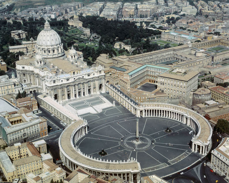
With this done, we’re back to our regularly scheduled maps of Vatican City. I’ll be drawing the Roman Necropolis next, which is the second-to-last part of St. Peter’s Basilica. That’ll be three maps in a row with quite a lot of death in them. I hope you guys like death. Any death fans out there? Let’s hope so. Anyway, I’m gonna go look up some floor plans for that and get to it. See you soon!


