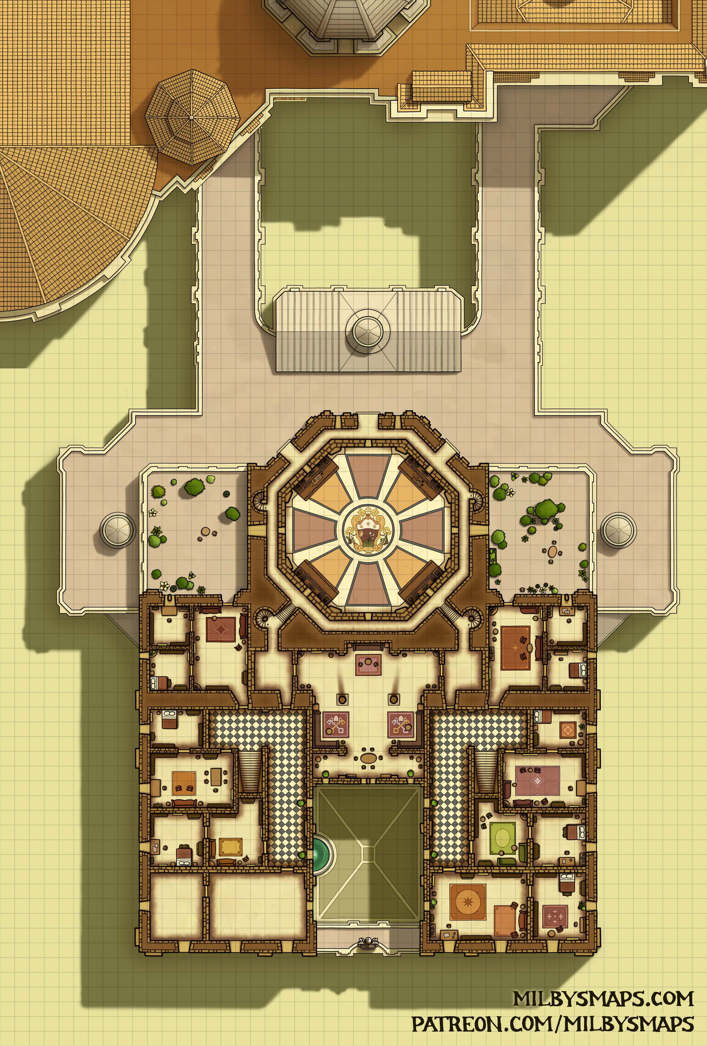
Vatican City: The Sacristy – 1st Floor

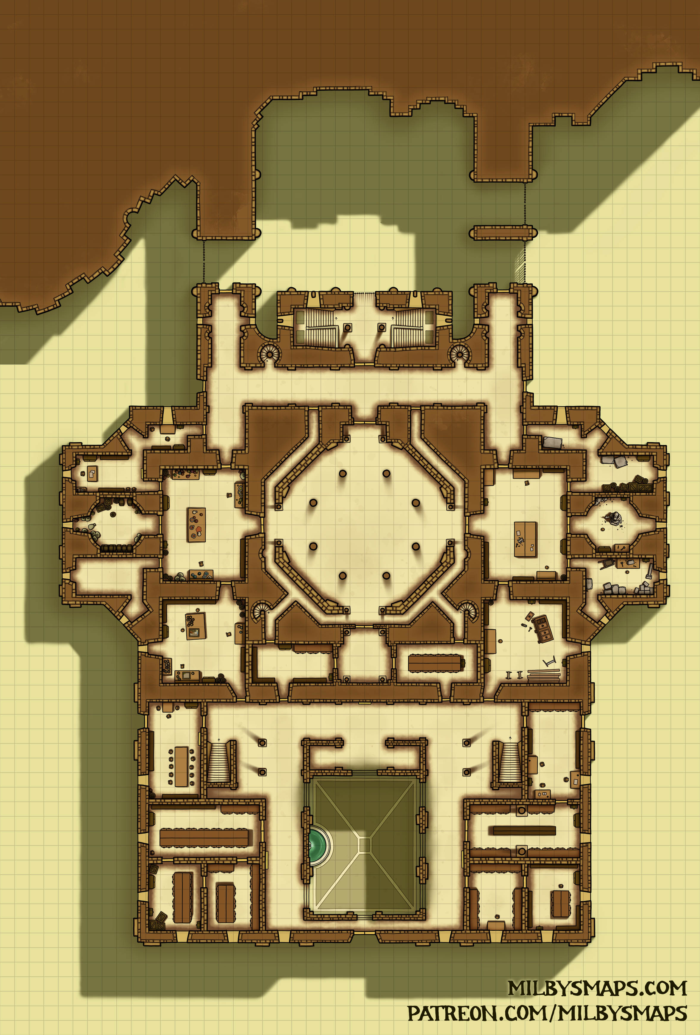
Here’s the first floor of the sacristy finished. It’s occupied by the Vatican Archives and the workshops of the Fabbrica di San Pietro, which is the organization responsible for the maintenance of St. Peter’s Basilica.

Okay, I’m gonna get back to work on the third and final floor. Be back with that before long!

By the way, If you want to see the rest of my Vatican City maps, you can find them all here.

Circensis: The Underworks

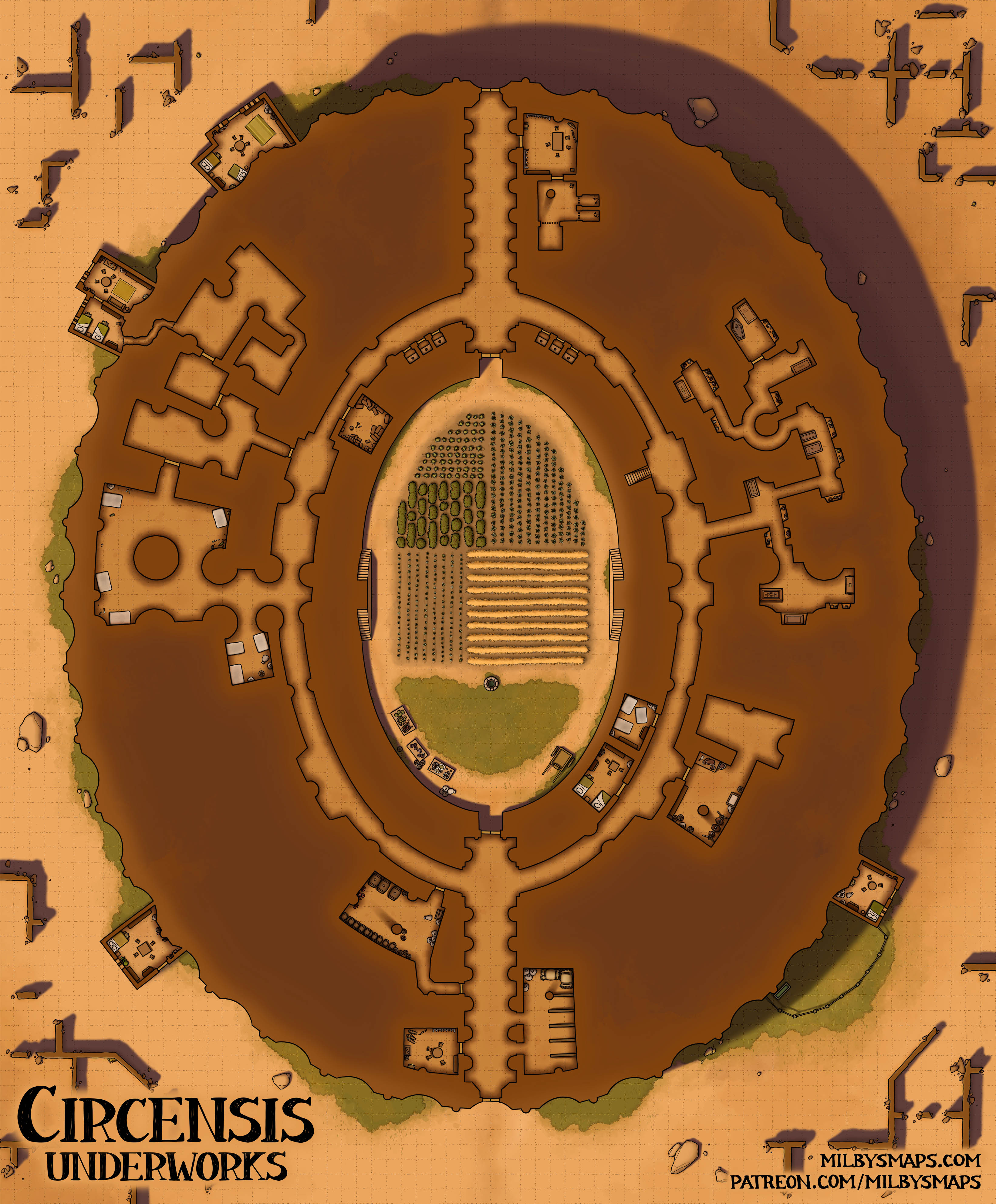
Here in the lower level of Circensis, there are some crypts, guard posts, a stable and a few other things. There are also a few disused chambers where the town’s poorest residents sleep.

I added a small tunnel leading into the underworks from the house in the upper left, which I thought might create some interesting possibilities. Maybe the party has to sneak into or out of the town and meets a group of smugglers who know about the passage. Or maybe a group of raiders finds out about it and sneaks in under cover of night. You may not have a use for it, but it’s there if you do.

With Circensis finished, I’ll be getting back to the Vatican. I’ll be drawing the Sacristy next, which is just south of St. Peter’s Basilica. This is where the passages at the bottom of the basilica map lead. Sacred relics were (and are) kept here, as well as the treasury. It also contains the workshops of the Fabbrica di San Pietro, the group of maintainers and restorers responsible for the upkeep of the basilica.

All right, that’s about it for now. Hope you like how Circensis turned out!

Rindlestone Hall

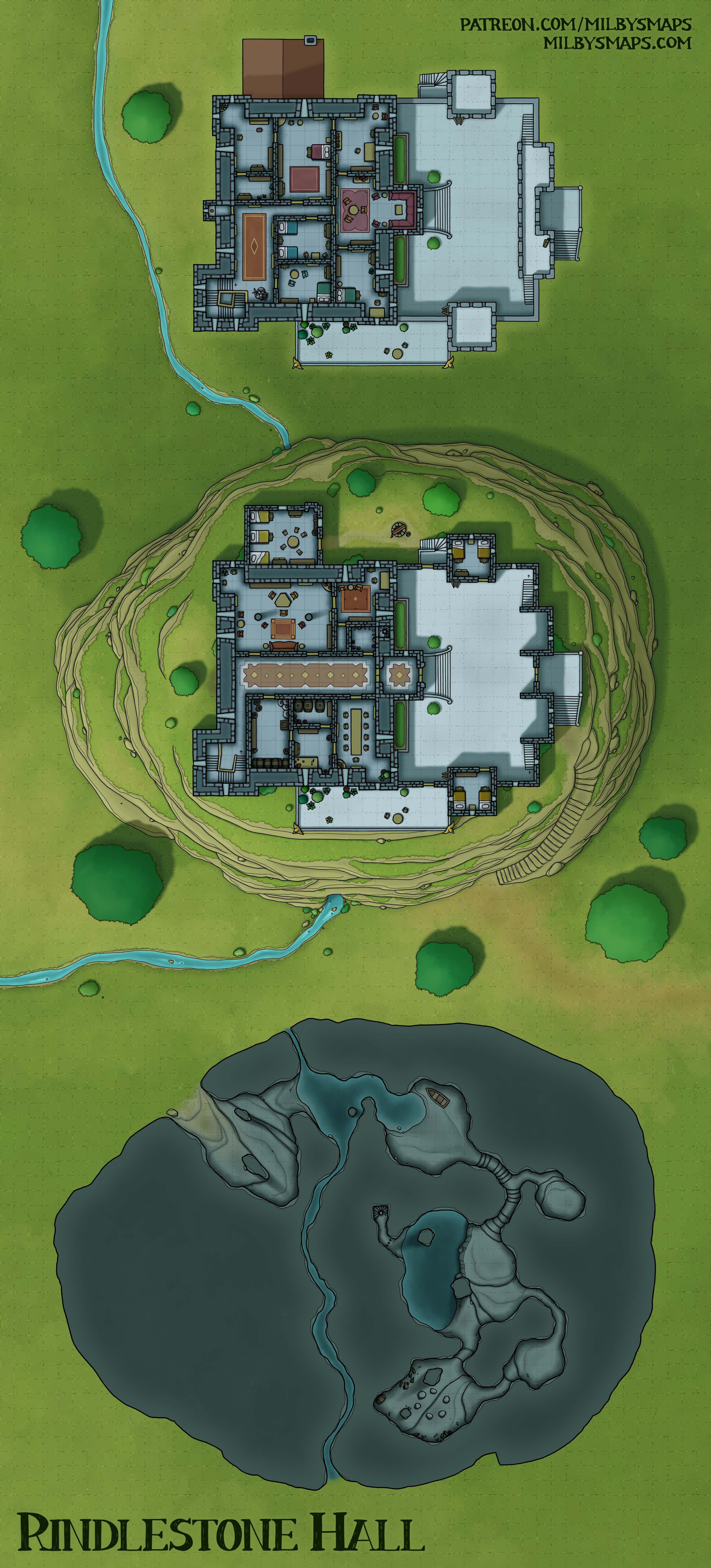
This map isn’t quite a real place, but it’s strongly inspired by one. Peveril Castle in Derbyshire, England is located over a cave called Peak Cavern, or “the Devil’s Arse.” According to legend, this cave “was where thieves’ cant was created by a meeting between Cock Lorel, leader of the rogues, and Giles Hather, the King of the Gypsies.”

Now, if you’re like me, you just heard a bunch of stuff you didn’t think existed outside of D&D. Thieves’ Cant is a real thing? And there’s a King of the Gypsies?! And– wait, rogues? What else are you hiding, England? Are paladins real, too? Can Anglican priests cast spells? Do your druids shapeshift? I WANT ANSWERS DAMMIT.

Okay, okay, I’m calm. Look, I just wasn’t expecting to learn that rogues and Gypsy Kings were inventing real-life Thieves’ Cant in a cave underneath a castle. I thought the most D&D thing in English maybe-history was Robin Hood and this kind of blows that away. Wow.

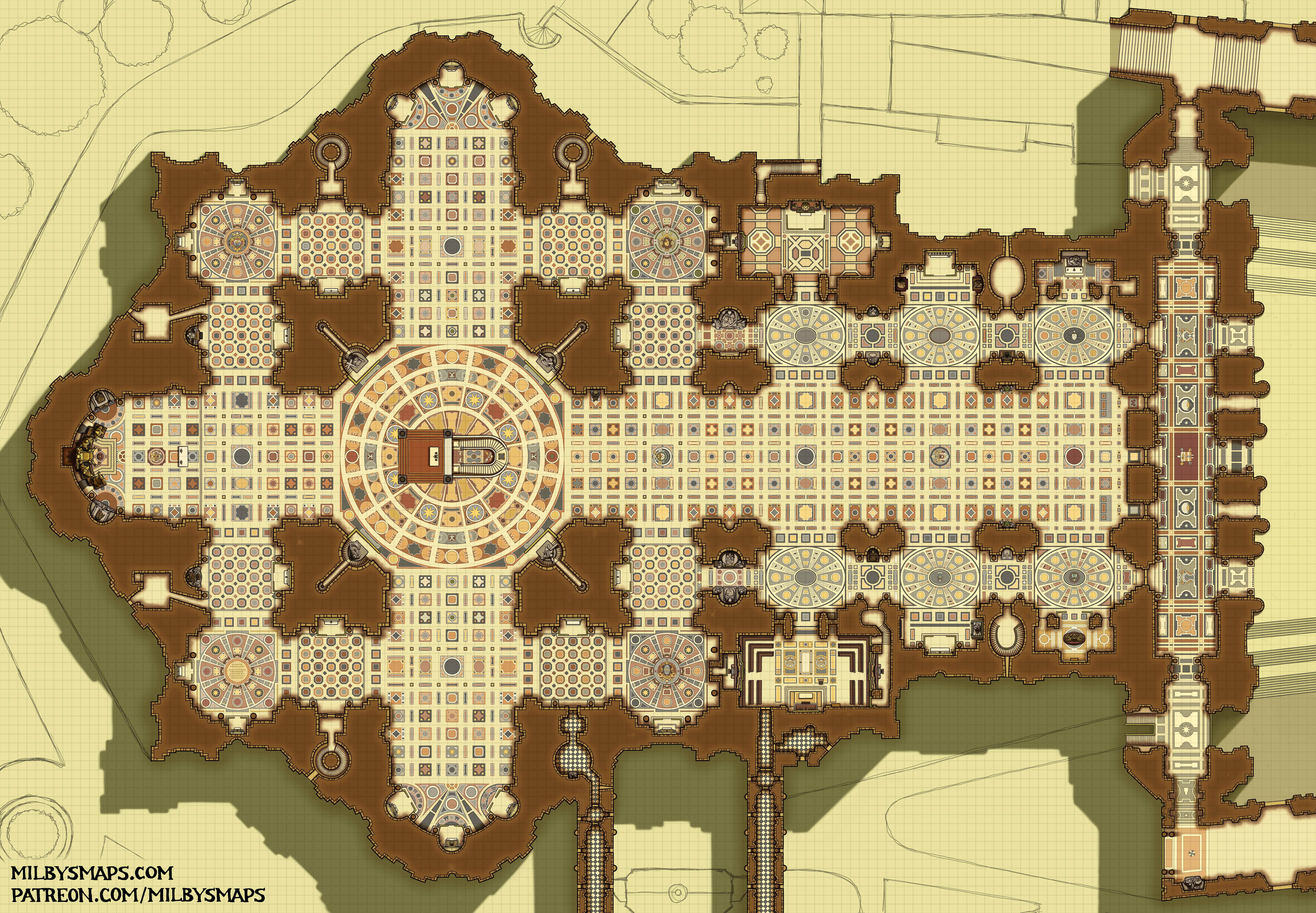
So, next up, I’ll be drawing the last part of St. Peter’s Basilica: the reliquary lodges. These are located inside the four main columns around the center of the basilica, so they’re pretty small and should only take a couple days to finish. I’ll say more about them when I’m done.

All right, I’m gonna get to it. See you soon!

Alverfjord

So, I mainly see Alverfjord as three things potentially:

  1. A village where a land-dwelling race lives alongside an aquatic race (such as sea elves, tritons, merfolk, etc). This was the original idea.
  2. A village whose residents are covertly controlled by someone living below. This could be an aboleth, a group of illithids or a coven of sea hags.
  3. A village whose residents are secretly up to some shady stuff, which they do in the tunnels below. Maybe this is a cult or some kind of criminal activity, like smuggling, fencing pirate loot or running ye olde meth lab.

For patrons, I’ll be making a low-tide version of this map, which should be up tomorrow. Most of the underground level is dry in that version and I suspect it’ll be better for people who want to use this for option #3 above.

Also, thanks to everyone for the feedback about the Vatican megaproject! The response was overwhelmingly positive, so I will be drawing that later this year. First, however, I’ll be drawing the river delta city project, which I should be able to start on in the next few months. I want to get a few maps drawn first, but I don’t think they’ll take too long. One of those is a spelljammer and I’ll be holding a vote among patrons to find out what kind of vessel you’d like to see. I haven’t drawn one in a while and it’s probably time.

Anyway, I think that’s it for now. I’ll be back with the low tide version for patrons tomorrow. Let me know what you think of the map!

The Stygian City: Bottom of the Pit

So, here we are at the bottom. Remember that circle-and-star symbol I’ve been drawing on the floors throughout this dungeon? Yeah. This is what that’s about.

So, the Stygian City is finished, but it’s not. For patrons, I’ll be drawing a few alternate bottom levels, which will include an underwater aboleth lair, a vault for some kind of artifact or entity, and a gateway to the underdark (or Hell or wherever). I’m also going to draw one where the bottom is just full of trash and debris, because I think that’d be pretty funny. What did you expect to find down there? A giant monster?

In my last post, I talked about an idea for the next megaproject. Just to let you know, the response was overwhelmingly positive, so that will be happening. I want to finish up the alternate levels of the Stygian City first, so it’ll probably be a couple months before I get started, but I’ll get to it before long.

I’m also going to make a Stygian City Codex for patrons, a brief overview of each level for non-patrons and there are a few more things I want to add to the DM notes.

But before all that, I’ll be drawing the next Cartographic Congress map, the Palace of Thorns. This is the palace of a dark fae lord, which is covered in vines and thorny overgrowth. I don’t know how I’m going to draw this place just yet, but I’ll figure it out.

Anyway, I hope you like the way I finished out the Stygian City! Let me know what you think.

The Stygian City 16, 17 & 18: The Myconid Village

The next batch of floors in the Stygian City includes a myconid village on the 16th level, an ancient oracle on the 17th and a center for magical research on the 18th. The next three floors will be the last and will include the thing that lies at the bottom of the pit: Ghanya. I’m also going to draw three or four alternate bottom levels for patrons, but that’s it for the canonical Stygian City.

To a large extent, I’ve been writing the lore of this place around building players up for a horrifying revelation when they reach the bottom and discover that people dug this giant hole and built a city around it so they could feed themselves to a monster. So I’ve really been looking forward to drawing the freakish monstrosity at the bottom of the pit and I’ll be doing that before long.

First, though, I’ll be drawing a map of a village carved into the sides of a river canyon with windows and balconies dotting the rock faces and rope bridges strung between the sides. It looks cool in my head, which usually means it’ll make a good map.

Anyway, if you’ve got any questions or thoughts about the map, let me know.

The Black Ziggurat

This map was heavily inspired by the Great Ziggurat of Ur-Nammu in Iraq. If you’ve ever seen a picture of a ziggurat, that’s probably the ziggurat you saw. I designed this primarily as the headquarters of an evil organization, but it could be used as a temple, cult lair or just a dungeon in the desert.

I made a bunch of alternate versions of this place for patrons, one of which was unintentional. Here’s how that happened. I was trying to make a version where the ziggurat was floating through the astral plane and I figured I’d do it by changing the colors. I’d make the sand blue so it’d look like nebulous waves of… you know, astral stuff in the background. My thinking was, it wouldn’t look like sand anymore since sand isn’t blue. Then I got up, grabbed a cup of coffee and, when I sat back down, I realized I had just made a night version of the map.

Anyway, I also made a proper astral version and another version without most of the interior (which is more accurate to the Ziggurat of Ur). Then there are unfurnished versions with and without the statues. Hopefully this fulfills all your ziggurat-related needs, whatever they may be.

Next, I’ll be drawing a ruined mage’s tower. I’ve got some ideas about how to make this place interesting, but let’s see how they look on paper. It’s definitely not going to be just a big cylinder, though. The world has plenty of maps like that. Once that’s done, I’ll get back to drawing more of the Stygian City.

All right, that’s it for now. Hope you like the map!

Scaligero Castle – Sirmione, Italy

So, there are eight buildings called Scaligero Castle in Italy. They were built by the Scaliger family, who ruled over Verona and were not very creative at naming castles. I mean, being fond of your own last name is fine, but maybe mix it up a little.

This is the Scaligero Castle in Sirmione, which has a very unusual feature: a fortified port. The port once held a fleet which the Scaligers used to control Lake Garda and its waterways. It’s mostly a fortification rather than a noble residence, so it’s fairly utilitarian in design, with most of the castle being defensive structures. The only two buildings inside are a barracks and a tower.

If you’re looking for a way to use this map in your game, allow me to suggest pirates. That’s what I’d use it for and something tells me I’m not alone there.

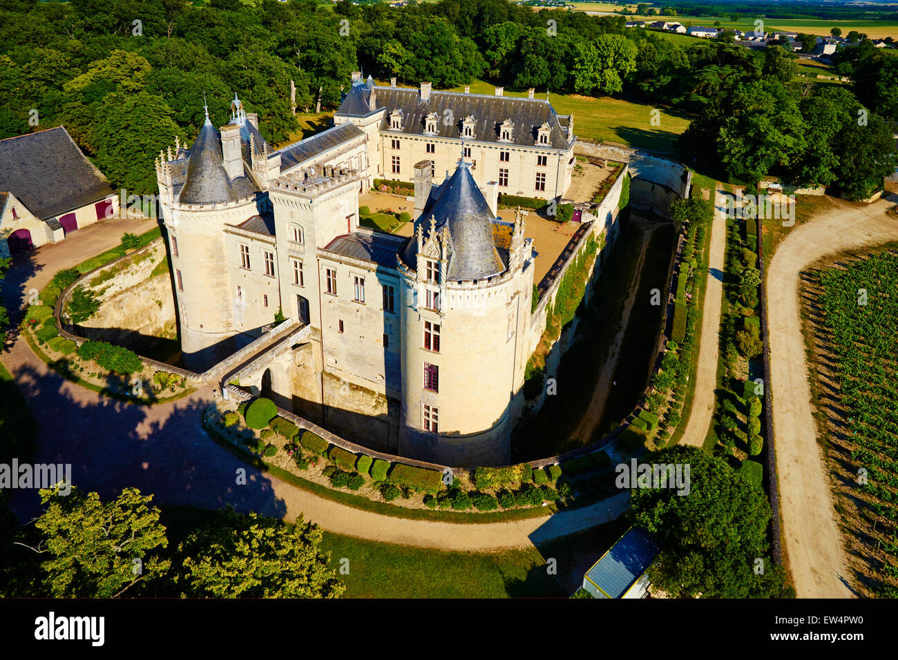
Next, I’ll be drawing a map I’ve been looking forward to making for a while now: the Château de Brézé. This is a French castle that looks like it was made for RPGs. There isn’t one photo that can explain this place, so let me walk you through it:

  • This is the Château from above. Note the dry moat surrounding it.
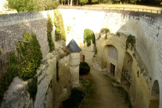
  • At the bottom of the dry moat, the walls of the moat are lined with tunnels and caverns. Here’s a photo of these. Here’s another.
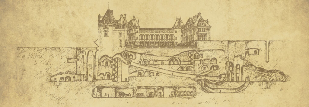
  • Some of these lead to very long tunnels. A lot of them are interconnected. And a lot of them predate the castle, having been dug as an underground settlement in the 1100s.
  • So, to recap: people dug tunnels, creating an underground settlement. 400 years later, someone built a castle over that settlement. Then, they dug more tunnels. This place is unbelievably fascinating.

So, that’s the place I’m going to draw for you. I’ve been wanting to draw the Château de Brézé for years and it is time. Wish me luck.

The Monastery of Varlaam in Meteora, Greece

Whew, this thing was a ton of work, but it’s finally done! This is a place I’ve wanted to draw for a long time and I was really glad to see someone propose it to the Cartographic Congress and win.

There’s something I didn’t realize about this place until I started working on it, though. I knew there was a mountaintop monastery in Meteora, Greece, but when I started looking for floor plans of the place, it turned out there are six. And there used to be twenty-four.

Imagine something for a moment. It’s the middle ages and you’re Greek. But the big city lifestyle was never for you, so you and a couple other fellas go out to the middle of nowhere, climb to the top of a giant rock formation and start building a monastery. Here, you can devote your life to God, get away from the rest of the world and live in quiet peace. And then some other people show up and start covering every rock in sight with twenty-three other monasteries. I mean, the first few are probably fine, but once they start hitting double digits, you’re probably ready to throw your hands up and move back to Athens.

So, here’s what I’ve got planned: I’m going to make a small map next. It’ll be something to do while I’m waiting for the last Tir Thelandira map to be decided on. If you’re a patron, the runoff vote is now open. After that, I’m going to finish Tir Thelandira and get started on that giant city-ship map I was talking about in this post. That’ll probably take a month or so to finish. It’s absolutely a megaproject and it’ll be bigger than any ship map I’ve ever seen by an order of magnitude or more.

Anyway. that’s what’s in the works. Hope it sounds good! Let me know what you think!

Wait, one last thing: if you’re a patron and you use Foundry, I just started a new Foundry module. Because Patrons’ Module 2 got so big that Foundry couldn’t export it without crashing. Not a joke. Anyway, you can find the link to install Patrons’ Module 3 on this page.

The Tower of the Moon

The elves of Tir Thelandira don’t know much about arcane magic. The magic that priests and druids can do? They understand that just fine. Basically, god does magic for you*. Simple. But wizard magic is something they don’t understand. And if you don’t understand it, you can’t teach it. And, in a society that can’t teach magic, there’s only one type of mage that can exist: wild mages.

A wild mage named Selaira lives here. She wasn’t the first to be born with an innate gift for magic, but she’s the first to really investigate it, to try to learn how it works. She’s the first to do experiments and write books about her findings. At the moment, she’s teaching other wild mages to better harness their abilities, but she’s starting to suspect that she can teach magic to people without an innate gift. If she figures that out, magic might go from being a rare gift to a widespread ability that affects every part of society.

Considering the major role that magic plays in other elven societies, this is a bit like peanut butter being mere moments away from the discovery of jelly. A very exciting moment in history, to say the least.

Next, I’ll be drawing the Chateau D’If. This is a 16th century island prison just south of France. Part of the book The Count of Monte Cristo takes place there. I’ll be drawing it as best I can with the limited amount of reference material available. Which is to say, I can’t find a proper floor plan, so I’m going to have to make some stuff up. Still, I think it’ll make a great map.

Anyway, I’m gonna get to work on Classy French Alcatraz. Let me know what you think of the map!

*I know this isn’t how everyone interprets it, but that’s how it works in my games.