
There’s an insane story about the Vatican Necropolis that I read while doing research for this map and I’d like to share it with you.
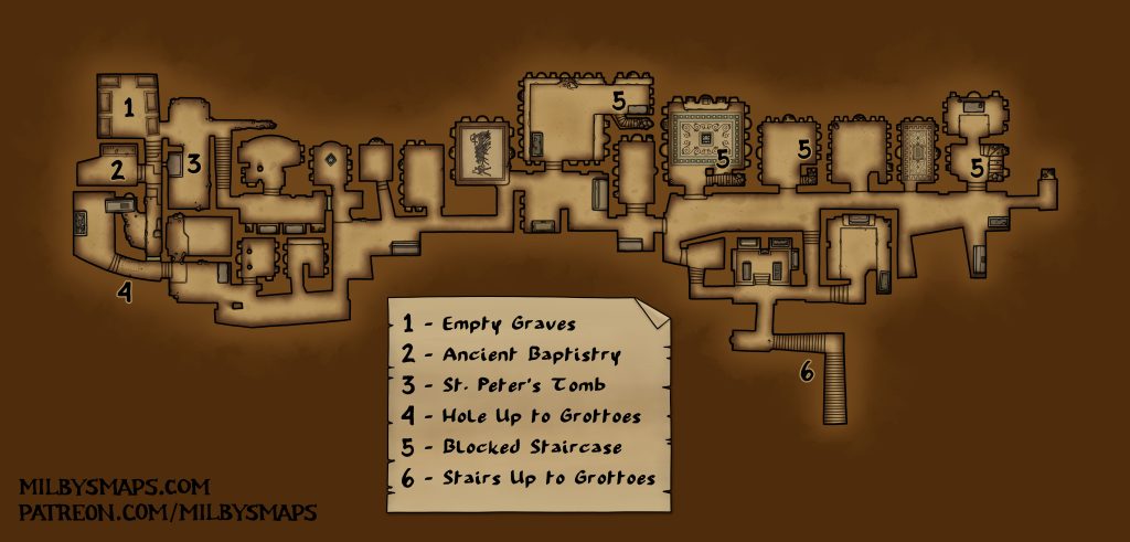
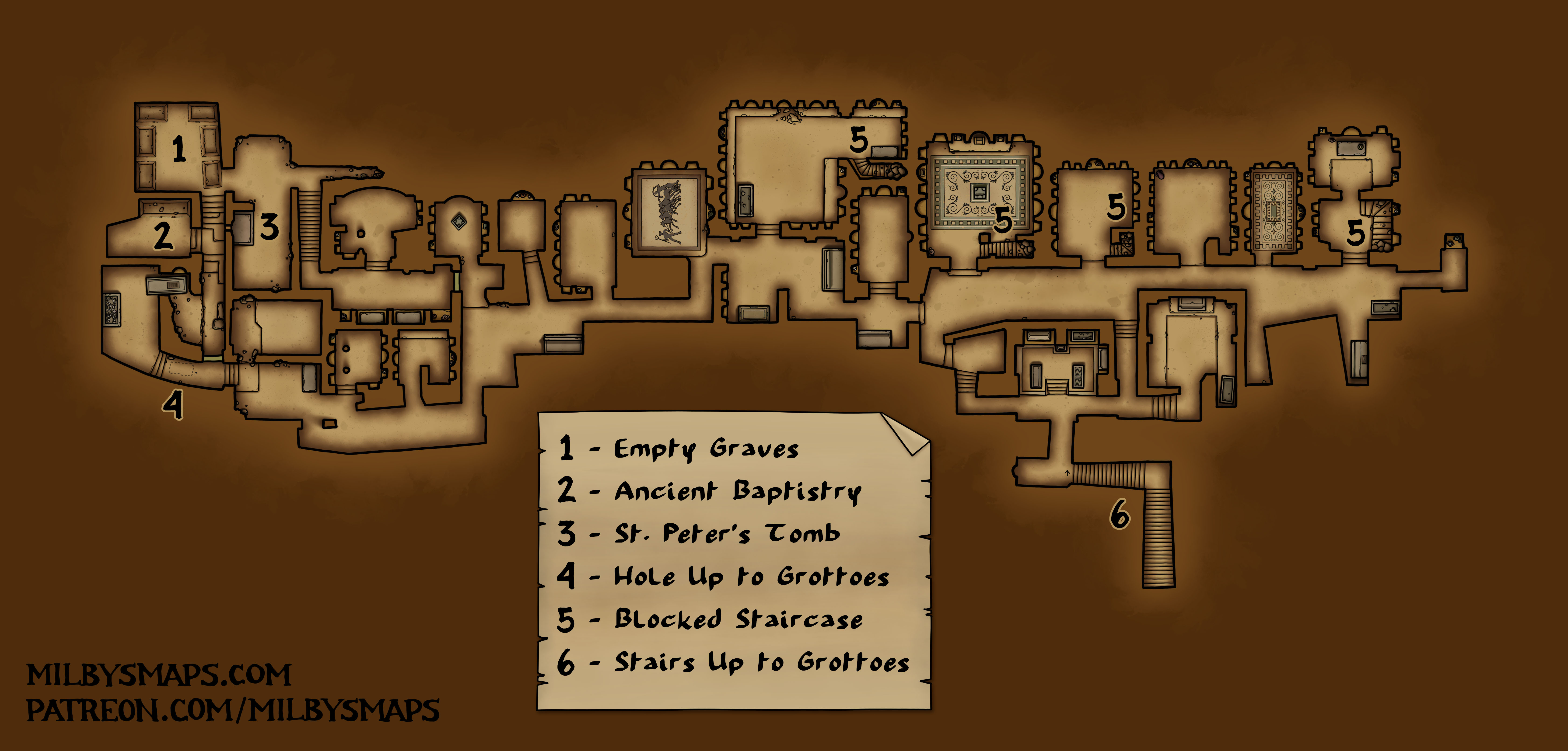
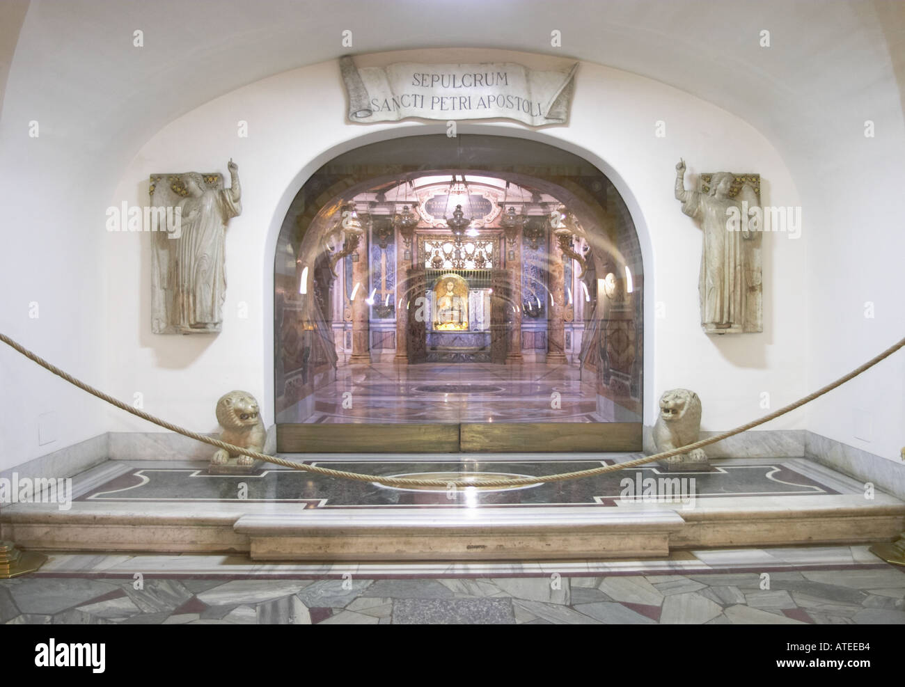
So, St. Peter’s Basilica was said to have been built directly over the grave of St. Peter, the first pope. His grave was well below the basilica, however, and was not accessible.
Then, in the 1940s, Pope Pius XII decided he wanted to open the Vatican Grottoes to tourists. There was a problem, though: the ceilings were too low. They couldn’t be raised because there was a basilica on top of them, so the floor had to be lowered. Workers were sent in to dig every room two feet deeper and put in new floors. And, in the middle of this, one of them broke through to something below.
The ancient, Roman tombs they found were considered likely to contain the tomb of St. Peter, so the pope sent a group of archaeologists to get in there and archaeologize the place. A priest named Ludwig Kaas, who had no education or experience in archaeology, was assigned to oversee the excavation.
Eventually, an archaeologist named Dr. Margherita Guarducci found St. Peter’s tomb. It was directly under the central altar of the basilica, it was lined with marble and there was graffiti that said it was him. Bingo. The only problem was that there were no bones inside. Dr. Guarducci wondered why they were moved and where they might be now. They started testing bones from the necropolis. Is this St. Peter? No, that’s a woman. How about this? No, that’s a teenager. This? That’s a sheep.
Ten years later, while talking to one of the basilica’s maintenance guys, Dr. Guarducci found out where the bones went. Apparently, Father Kaas had been going into the dig site at night, taking out any bones he found and putting them in boxes. Without telling anyone. They’d been in a storeroom for a decade and Father Kaas never said anything. For ten years, he watched people search the necropolis, test remains and painstakingly examine the site for clues about where St. Peter’s bones might be. And this dude said absolutely nothing. And then he died.
And that’s how the bones of St. Peter were discovered by archaeologists. In a box in a closet.
Next, I’ll be drawing a castle sitting over an elaborate cave system, containing a meeting place for the local thieves’ guild. It should be a useful map for adventures where the players are going somewhere that’s normal on the outside, but shady on the inside. Secret gangs, cults, conspiracies and so on. Have you seen Hot Fuzz? That sort of thing.
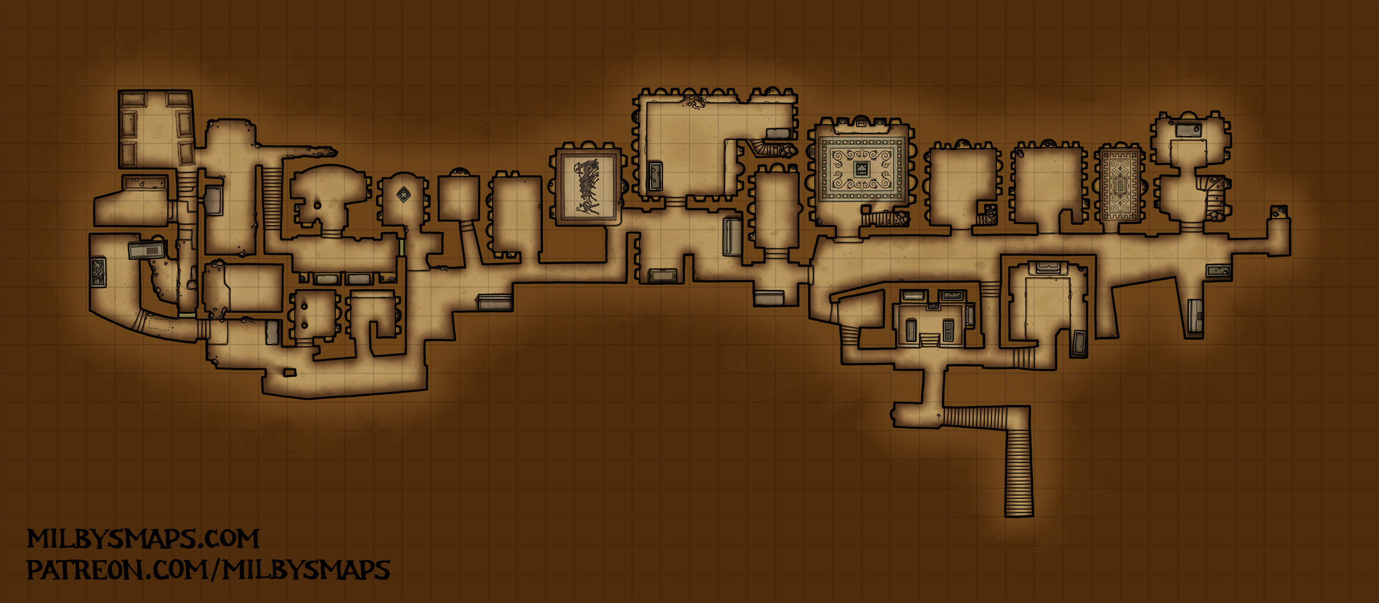
After that, I’ll be drawing the last part of St. Peter’s Basilica, which is the reliquary lodges. They’re small and won’t take more than a couple days.
All right, that’s about it. Let me know what you think!


