Fiachna’s Knoll

Fiachna’s Knoll is an elven town in Tir Thelandira. With this done, there are only two more maps to draw before the island is finished. The next will be the one proposed by Magpie and voted for by patrons: the ruins of a monument built by a civilization so ancient that it preceded even the elves’ arrival on Tir Thelandira.

I’ve been thinking about what this place should be and I’ve decided to make it the absolute last thing you’d expect to find on an island full of wood elves. And what would that be? The most dwarven thing ever. These ruins are going to be more dwarven than a drunken axe-throwing contest. Of course, the elves of Tir Thelandira have never actually seen a dwarf, so they wouldn’t know what to make of it, which could lead to an interesting conversation if a party with a dwarf passes through.

After that, there’s still one more map to go. I’ll be sending out a message to all patrons asking for proposals for location #2 in the next few days. Here are a couple guidelines: first, the location can be anywhere on the northern island. And second, Tir Thelandira is very isolated, so the location can’t be a major city.

Anyway, this megaproject should be wrapping up soon and then I’ll get started on the next one, which will be that giant ship I mentioned earlier. Hopefully that sounds good to everyone!


Hohenzollern Castle

Here’s the annotated version. No reason both of us should have to type a bunch of text from old, German maps into Google Translate.

I’ve had a few people working on academic papers message me about my historical maps and I want to make something clear for anyone who googled their way here: FOR THE LOVE OF GOD, DO NOT USE MY MAPS AS REFERENCE FOR ACADEMIC RESEARCH. If you can’t find a complete, contemporary floor plan, I probably didn’t either. And– this is important– I’M ALLOWED TO FILL IN THE GAPS BY MAKING STUFF UP. The idea that I might inadvertently rewrite history by making D&D maps is slightly hilarious, but ultimately something to avoid.

*ahem*

With that out of the way, Hohenzollern Castle, in Baden-Württemberg, Germany, was the ancestral seat of the Hohenzollern Dynasty. The Hohzenzollerns were the rulers of Prussia and, later, Germany. They also produced some of the most potent mustaches in Central Europe. Without getting too far into it, let’s just say things went well for the Hohenzollerns right up until they didn’t.

This map turned out to be a ton of work, but I hope you like it. Next, I’ll be drawing the map chosen by the last Cartographic Congress: a small, fortified dwarven port town. Erik, who proposed the idea, plans to use it as a part of Brazenthrone, so I guess you could consider this an unofficial expansion of the dwarven city.

Okay, that’s it. I’d love to hear what you think of Hohenzollern Castle!

Cave of the Sun

The Cave of the Sun is another map for Tir Thelandira. It’s an oracle and holy site where the elves gather to seek guidance from their goddess. The cave takes its name from a hole in the roof of the cavern, through which light beams down onto the pool within.

I’ll draw more of Tir Thelandira next month, but right now there’s something I have to draw. It’s Italian– Venetian, to be specific– and it’s glorious. It’s not a real place, but it could have been a real place. Unfortunately, somebody screwed up. Let me explain.

In Venice, there’s a famous landmark called the Rialto Bridge. Before it was built, proposals by several architects were considered and the one they went with was this. And, I mean, it’s fine. I don’t hate it. The problem is that a guy named Andrea Palladio proposed this. And they passed on that.

Was it because the guy who made the winning proposal was named Antonio Da Ponte and his last name is literally the Italian word for bridge? Was there a bribe involved? I don’t know. Maybe no one knows. But I do know this: I am going to make a map of Andrea Palladio’s objectively superior bridge. And I’m going to do it right now.

I want to thank Masque for telling me about Andrea Palladio’s design for the Rialto. I might never have found out about it otherwise. Just to let everyone know, I’m always open to suggestions and I’ve drawn a few of them. So don’t hold back on me. There’s no such thing as too many ideas.

Secret Room: Cult Shrine

Here’s the cult shrine secret room. You’ve got a big, demonic head, a sinister-looking glyph on the floor and some nice scented candles to freshen the place up a little.

I said this was going to be the last secret room, but people seem to like these, so I’m going to do one more: a vault. That’s a common type of secret room that’s missing from these, so I’m going to draw one. It won’t take long. In and out. Quick, one-day map. I’ll have that for you tomorrow and then I’ll be drawing something much, much bigger.

Sound like a plan?

Akshardham Temple: The Interior

Several months ago, a patron said that India was underrepresented in fantasy settings and I agreed. Take the Forgotten Realms, for example. Faerun is inspired by Europe, of course. Then you’ve got Zakhara, the Arabian part of the world. And then there’s Kara-Tur, which is East Asia, and Maztica, which is Mesoamerica. Technically, there’s an Africa, but almost nothing is written about it, so that doesn’t really count. But there’s no India.

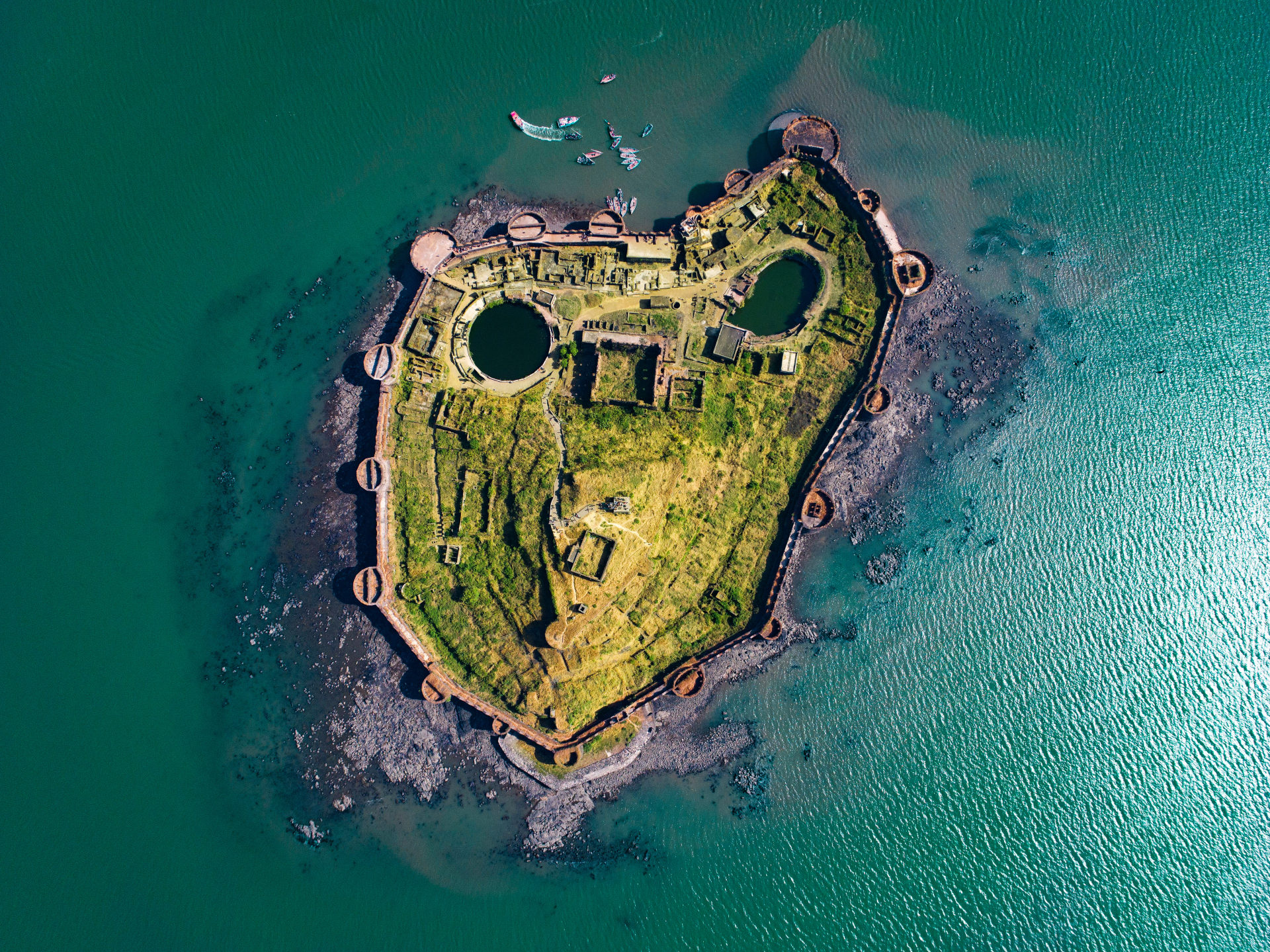
Well, I can’t make a whole Indian setting, but I can draw a map of something Indian and I decided to go with Akshardham Temple. I’m going to draw another map of a historical place in India next, but for a different reason. The island fortress of Murud-Janjira won last month’s Cartographic Congress, so we’re going to have a subcontinental doubleheader.

For a few reasons, I’m going to draw the place in ruins as it is today. The first is that I think it’s more interesting that way. And it doesn’t prevent it from being used as a fort, since, in FRPGs, ruins tend to be occupied by pirates, goblins, ogres, cultists, etc.

The second reason is that, after an hour of searching, the only labeled floor plan I’ve found of this place is in Hindi. Or possibly a different Indian language. In any case, my keyboard doesn’t have those buttons on it, so I can’t use Google Translate to find out what everything is. But if it’s in ruins, that’s not really a problem *taps forehead*.

Anyway, I’m gonna grab some coffee and get started on that. Let me know what you think of the map!

Akshardham Temple: The Exterior

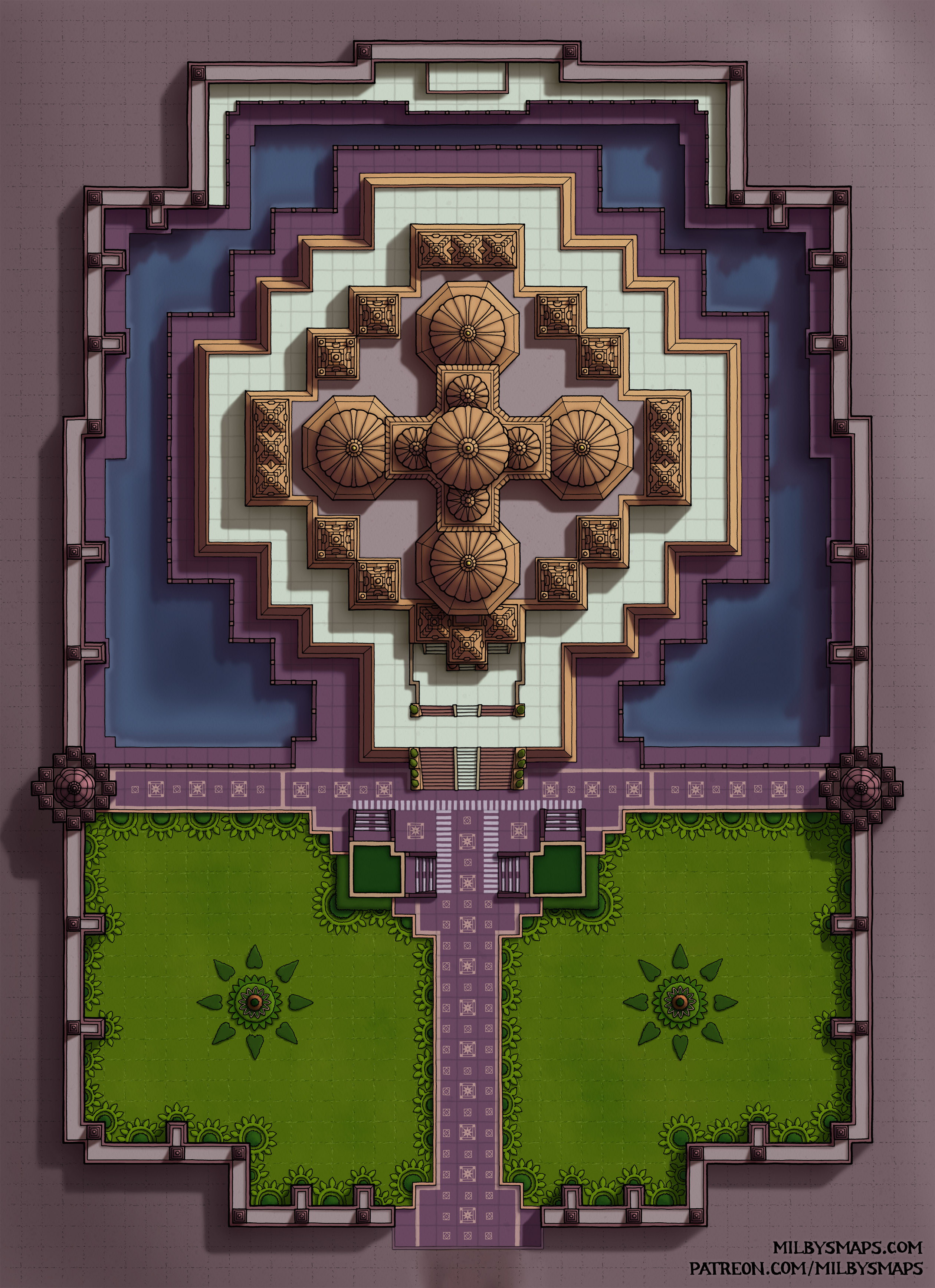
Akshardham is a Hindu temple in New Delhi, India. This monument to the gods was constructed long, long ago, back in the year… *checks notes* 2005. Few remember what life was like in those ancient times, but historians say the telephones of that era could be folded in half. I didn’t actually realize this place was so new until I’d already started drawing it, but I’m really happy that people are still building places that would make good fantasy maps.

Akshardham is dedicated to several deities, but the primary one is Swaminarayan. I’m not actually clear on whether Swaminarayan is a god or not, but he is believed to be the manifestation of Krishna, who is definitely a god. So, does that make him a god by extension? I don’t know enough about Hinduism to answer that question, but in any case, they did build a pretty spectacular temple in his honor.

Next, I’ll be drawing the interior of the temple, which should only take a few days. After that, I’ll be drawing the map chosen by last month’s Cartographic Congress, which is also a real place in India: Murud-Janjira, an island fort just off the western coast. Having just drawn the map above, I am very pleased to say that Murud-Janjira has no roof whatsoever. THANK GOD. You make a lovely roof, guys. You really do. But they’re not easy to draw.

Anyway, I’ll have DM notes and all that once I’m done with the interior, but until then, I hope you like the map!

The Sewer’s Terminus

So there are two unusual things about these sewers. First, they run through the ruins of an ancient dwarven settlement, which makes them a little more interesting to explore and gives a little space for things to happen.

And second, the sewers don’t flow out into a lake or a river. They flow down. Maybe into more dwarven ruins. Maybe into the underdark. Or maybe the sewage flows into the groundwater that the people in the city above drink from. That’s the circle of life. For dysentery.

Anyway, I think this would be a good map for an urban adventure or an entrance/exit to the underdark. Just remember: if anyone falls down in the water, make them save to avoid a disease. Roll a three? That’s the worst case of Valderian Bat Herpes the apothecary has ever seen.

Next up, I’ll be drawing one of the last 3 locations in the Black Loch: the Submerged Ruins. I’m not sure what it’s going to be yet, but I think it’ll be something that used to be above the water, but was drowned when the Great Breach opened. Anyway, I’ll figure it out.

Well, that’s it for now. Hope you like the map!

The Sanctum of Psor’il

Here’s an alternate version without the worm.

For a number of reasons, I don’t draw monsters in maps. It might look like that’s what I did here, but… it is and isn’t a monster. Allow me to explain. Psor’il, the aboleth who resides here, is trying to bring a creature from a bizarre, hostile dimension into the Black Loch.

To allow it to cross over, the aboleth’s minions are making a substance called “schismic flux,” which weakens the barrier between dimensions. They’ve weakened it quite a bit, but not enough for the creature to pass through. So, at the moment, the creature is stuck in between planes. And it’s visible in this world, but it’s not tangible yet. In other words, the monster is scenery. Weird, scary scenery, but not a monster. Yet.

I’m very curious what your opinions on it are. I was trying to make this place as strange as possible and that was one of the things I came up with. I also made a version without the worm in case anyone objects.

Next, I’ll be drawing the map chosen by last month’s Cartographic Congress: a sewer system with tunnels that cut through ancient, dwarven ruins, leading deep into the earth. After that, I’ll be back to the Black Loch to draw one of the last 3 locations.

Anyway, I’d love to know what you think about the map. And I know it’s kind of a strange one, so if you’ve got any questions, feel free to ask!

The Blind Colossus

The Blind Colossus is a huge, eyeless statue in the Black Loch. Sailors who have seen it think it depicts a human, which is a strange sight deep in the underdark.

The truth is that the Blind Colossus was built by a tribe of humans called the Ardyeni, barbarian raiders who were driven underground thousands of years ago. They lived in the Black Loch for over a millennium, building a city and several outlying towns in the deep reaches of the loch. They are the ancient ancestors of the race known as “grimlocks.”

There’s a long story about how this happened in the DM notes, but I’ll try to summarize it for everyone. A few hundred years after the tribe was driven into the underdark, an Ardyeni mage created a device to speak to the gods. It sort of worked.

The Ardyeni king spoke with an entity named Bylir, who wasn’t a god, but a being from the Far Realm. The best explanation I can give is that Bylir is the sort of thing H.P. Lovecraft would write a story about. Not a god, not a demon, but very powerful. Definitely not your friend.

Anyway, the Ardyeni started to worship this thing. Bylir gave them blindsight, which let them see in the darkness. Then Bylir took their eyes away. Then it began demanding blood sacrifices. And finally, after a few centuries, Bylir gave them to an aboleth as slaves.

Several thousand years later, the device used to contact Bylir still survives inside the Blind Colossus. The descendants of the Ardyeni survive as well, but have changed a lot and are no longer considered human. Many of them still serve the aboleth, who lives in the ruins of their ancient civilization.

Speaking of which, the next map will be the lair of that aboleth. It’s one of four more maps left to draw for the Black Loch and I’ve got some interesting ideas for it.

Anyway, I think the Blind Colossus came out pretty well, but it’s a fairly unusual map and I’m curious what people think about it. If you’ve got any thoughts, let me know!

Elderseed Sanctuary

Elderseed Sanctuary is a small treehouse settlement in a giant baobab. I designed it with a druid community in mind, but it could easily be a village of wild elves as well. Or aarakocra. Or avariel. Or weresquirrels.

Here’s a question to think about: is it a treant? If so, that makes this place mobile, which allows for some interesting possibilities. For example, your party could make camp in the woods and wake up next to this thing. That could be a handy approach if your party isn’t great at following a trail of breadcrumbs to the next adventure. Just park the next adventure on top of all their stuff and see if they can work out what to do.

Next up, I’ll be drawing another map from the Black Loch. This time, it’ll be the ancient crypt on Cairnhollow Isle. I’m not sure exactly what I’m doing with it, but I think it’ll be a fairly decrepit series of winding tunnels and catacombs, leading to a huge, elaborate burial chamber at the end. I’ve got a bunch of maps of the Paris Catacombs, so hopefully I can give the map a fairly authentic feel.

Well, that’s it for now. Let me know what you think about the map!